

Category: What’s Happening
Abstract / Executive Summary
Transboundary haze pollution remains a recurring environmental governance challenge in Southeast Asia, where land and forest fires, seasonal weather patterns and cross-border atmospheric transport can expose populations to smoke originating beyond their national boundaries. In 2026, the problem has again become prominent across ASEAN, particularly in the southern region, where prolonged dry conditions and widespread fire hotspots have contributed to significant smoke haze. The ASEAN Specialised Meteorological Centre (ASMC) activated its highest regional haze alert level on 26 August 2026, while subsequent developments have highlighted continuing concerns about prevention, accountability and coordinated response.
This article examines transboundary haze as both an environmental management problem and a regional systems-governance challenge. Drawing on current ASEAN monitoring information, regional policy frameworks and World Health Organization guidance, it evaluates the relationship between meteorological forecasting, fire prevention, institutional coordination and public-health protection. It argues that regional cooperation requires more than agreements and emergency alerts: it depends on reliable data, compatible information systems, clear institutional responsibilities and the ability to translate evidence into timely action. Digital environmental platforms, geospatial analysis and integrated reporting can support these functions, although technology cannot substitute for enforcement, prevention or political cooperation.
The article also considers the relevance of documented environmental information-system and geospatial platform experience within Eywa Systems’ portfolio. This connection is presented as a potential application of established capabilities, not as evidence of a completed transboundary haze project. The article concludes with practical implications for ASEAN institutions and national authorities pursuing more accountable, evidence-led and sustained haze prevention.
Keywords
Transboundary haze pollution; ASEAN; environmental governance; forest fires; geospatial information systems; environmental monitoring; regional cooperation; digital public infrastructure.
Main article
1. Introduction
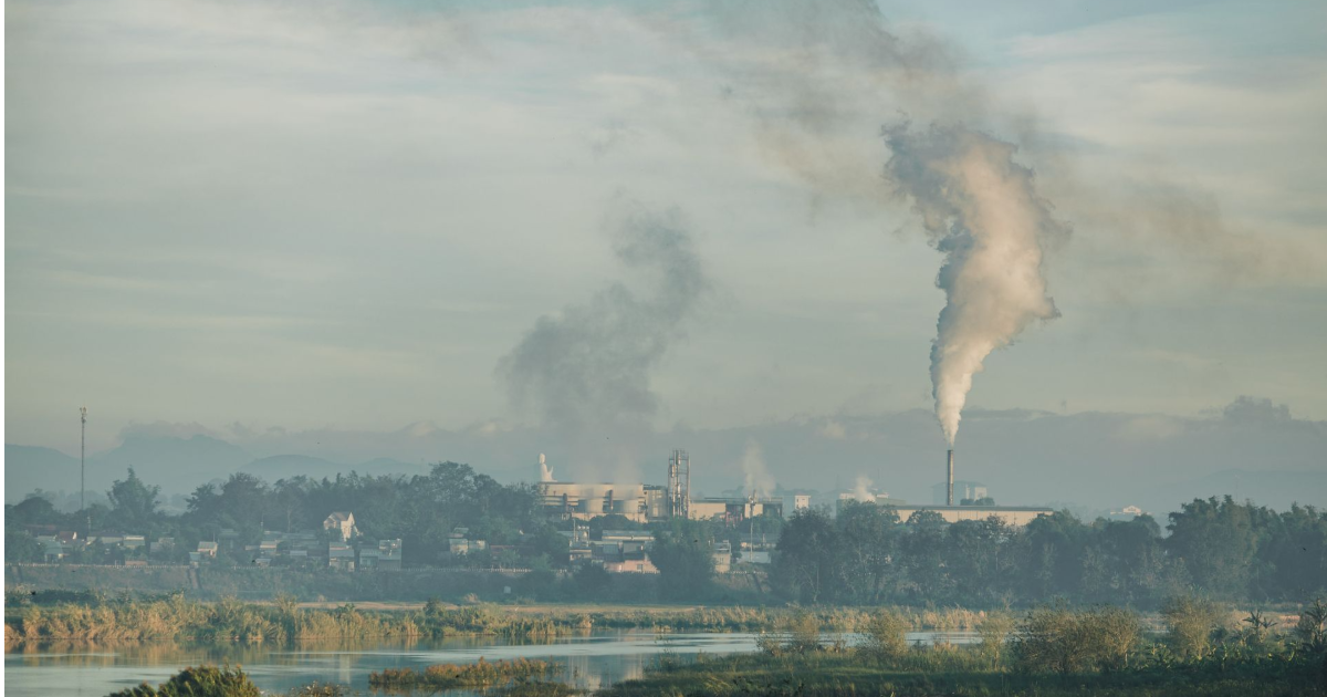
Smoke does not stop at a national border. During Southeast Asia’s recurring haze episodes, fires in one part of the region can affect air quality, public health and economic activity in neighbouring countries. The resulting problem is difficult to address through domestic environmental policy alone: the location of a fire, the direction of prevailing winds, the distribution of exposed populations and the authority to intervene may all fall within different jurisdictions.
The issue has returned to prominence in 2026. On 26 August, the ASEAN Specialised Meteorological Centre (ASMC) activated Alert Level 3 for the southern ASEAN region, citing persistent dry conditions and widespread smoke haze associated with fire hotspots in Kalimantan and Sumatra. On 19 October, Singapore’s National Environment Agency announced additional preventive notices concerning fires in Indonesia, illustrating how the regional problem can also lead to national enforcement action (ASMC, 2026a; National Environment Agency [NEA], 2026).
These developments raise a central policy question: why does transboundary haze remain difficult to prevent and manage despite decades of regional cooperation?
This article addresses that question by examining three connected dimensions: the physical and public-health characteristics of haze; the institutional arrangements governing ASEAN cooperation; and the data and operational systems needed to support prevention, monitoring and response. Its geographic focus is Southeast Asia, with particular attention to the southern ASEAN region and implications for the wider regional cooperation framework.
The central argument is that effective haze governance requires an integrated chain of action, from identifying fire risk and detecting incidents to verifying their sources, coordinating intervention and communicating exposure risks. Regional environmental data and digital platforms can strengthen this chain, but their value depends on institutional accountability, consistent information and effective action on the ground.
2. Understanding Transboundary Haze Pollution
2.1 A shared atmospheric problem with multiple causes
Transboundary haze pollution refers to smoke-related air pollution that crosses national boundaries, commonly in connection with land and forest fires. In Southeast Asia, the problem has historically been associated with vegetation and peatland fires, land clearing, agricultural practices and prolonged dry conditions. The relative contribution of these factors varies by location and event; individual haze episodes should not automatically be attributed to a single cause.
Meteorology plays a critical role in determining where smoke travels and how long it persists. Rainfall influences vegetation and peat moisture, while wind direction and speed affect smoke transport. Fire hotspots detected by satellites provide important indications of possible fire activity, but a hotspot is not, by itself, definitive proof of a particular fire’s origin, land ownership, cause or responsible party.
The ASMC’s regional monitoring framework reflects this distinction by considering hotspot distribution, observed smoke haze, rainfall and prevailing winds when assessing the risk of transboundary haze (ASMC, 2026b). Reliable analysis therefore requires multiple information sources rather than reliance on a single satellite image or hotspot count.
2.2 Why the health implications extend beyond the fire zone
Smoke from landscape fires contains particulate matter and a mixture of gases and other pollutants. Fine particulate matter, commonly measured as PM2.5, is particularly relevant because its small size allows it to penetrate deeply into the respiratory system.
The World Health Organization (WHO, 2026) identifies respiratory irritation, asthma exacerbation, breathing difficulties and cardiovascular effects among the potential consequences of exposure to wildfire smoke. Children, older adults, pregnant women and people with existing health conditions may face heightened risks. Outdoor workers and communities with limited access to healthcare or cleaner indoor environments may also be disproportionately affected.
These findings establish a strong general basis for treating smoke pollution as a public-health concern. They do not, however, quantify the health burden of a specific ASEAN haze episode. Such estimates require event-specific exposure data, population information and appropriate epidemiological methods.
Haze also creates consequences beyond clinical health outcomes. Reduced visibility can disrupt transport, while prolonged exposure may affect schooling, outdoor work and everyday activities. The scale and distribution of these impacts depend on the duration and intensity of exposure, local conditions and the capacity of institutions to protect affected populations.
3. ASEAN’s Regional Governance Framework
3.1 From regional agreement to operational implementation
ASEAN adopted the ASEAN Agreement on Transboundary Haze Pollution (AATHP) in 2002 following the severe land and forest fires of 1997–1998. The agreement entered into force in 2003 and has since been ratified by all ASEAN Member States. Its framework covers monitoring and assessment, prevention, preparedness, emergency response, technical cooperation and scientific research (ASEAN Haze Portal, n.d.).
The agreement recognises that the problem requires concerted national efforts alongside regional and international cooperation. It provides a basis for coordination rather than replacing the domestic responsibilities of individual states.
ASEAN’s Second Roadmap for Cooperation on Transboundary Haze Pollution Control, covering 2023–2030, reinforces the ambition of achieving a transboundary haze-free ASEAN by 2030. It adopts a multidisciplinary and science-based approach and identifies implementation mechanisms, targets and indicators for tracking progress (ASEAN Secretariat, 2024).
These instruments establish an important institutional foundation. However, the existence of an agreement or roadmap does not itself demonstrate that fires will be prevented, responsible parties held accountable or exposed populations protected. Those outcomes depend on implementation, operational capacity, enforcement and cooperation across national institutions.
3.2 The continuing coordination challenge
Haze management involves actors with different responsibilities: environmental regulators, forestry agencies, meteorological services, emergency-response teams, public-health authorities and regional coordination bodies. Each may collect different information for different operational purposes.
A forestry agency may need to identify fire locations and land-management responsibilities. A meteorological service may need to predict smoke movement. A public-health authority may need to identify exposed populations and issue protective guidance. A regulator may require documented evidence before taking enforcement action.
If these datasets are fragmented, delayed or difficult to reconcile, institutions may struggle to build a common operational picture. Even where information is available, differences in geographic identifiers, reporting intervals, data quality and access arrangements can limit its usefulness.
This is a systems-governance problem as much as a technical one. Effective coordination requires agreement on who collects information, who validates it, who is authorised to act and how the results of that action are reported. Digital integration can support these arrangements, but cannot resolve unclear mandates or competing institutional incentives by itself.
4. What the 2026 Haze Situation Reveals
4.1 Persistent risk despite monitoring and warning systems
ASMC’s 26 August 2026 Alert Level 3 announcement reported widespread hotspots in Kalimantan and southern Sumatra, alongside moderate to dense transboundary smoke haze. Its subsequent seasonal outlook for October–December 2026 warned that below-normal rainfall across parts of the region, together with strengthening El Niño conditions, could sustain an elevated risk of hotspots and smoke haze. The outlook also noted that returning showers could begin to alleviate conditions in parts of the southern region (ASMC, 2026a).
These statements are forecasts and risk assessments, not guarantees about how conditions will develop. Rainfall distribution, local fire activity and changing winds can alter the situation. Nevertheless, the outlook demonstrates why haze preparedness needs to operate before air quality deteriorates: the relevant risk factors can be monitored and assessed in advance.
A warning system is valuable only if institutions can turn its outputs into timely decisions. Depending on the circumstances, these may include deploying firefighting resources, investigating potential violations, protecting vulnerable communities or coordinating assistance across borders.
4.2 Enforcement and accountability remain essential
Singapore’s NEA reported on 19 October 2026 that it had issued preventive measure notices to seven companies in Indonesia concerning fires in Sumatra. It also announced that it would issue notices to three additional companies following indications that smoke from fires in Kalimantan might have moved to Singapore (NEA, 2026).
The distinction in the agency’s announcement matters. The notices and reported indications are evidence of preventive enforcement activity; they should not be treated as final judicial findings that every named company was legally responsible for transboundary pollution.
The case nevertheless illustrates an important governance requirement: monitoring data must be connected to a process for investigating incidents, assessing responsibility and taking legally appropriate action. Satellite observations may help identify potential incidents, but attribution can require additional evidence concerning land tenure, concessions, fire history, weather and other relevant circumstances.
The broader lesson is that transparency and accountability require traceable evidence and due process. More data alone do not guarantee either.
4.3 The northern and southern regions require different approaches
ASEAN’s haze challenges are not confined to one season or one group of countries. The southern ASEAN region and the Mekong subregion experience different seasonal patterns, which is one reason regional cooperation has included distinct subregional arrangements (ASEAN Haze Portal, n.d.).
In 2026, Copernicus Atmosphere Monitoring Service reported severe haze affecting parts of upper Southeast Asia during the spring, with elevated PM2.5 concentrations in several major urban centres. Its analysis also noted particularly high estimated wildfire carbon emissions in Thailand during April (Copernicus Atmosphere Monitoring Service, 2026).
These findings show why a single regional response calendar would be inadequate. Preparedness should reflect local fire regimes, agricultural practices, weather conditions, institutional capacity and the timing of seasonal risks. Shared regional standards can support coordination, while operational plans need to remain responsive to subregional conditions.
5. Building a More Effective Environmental Information System
5.1 From isolated datasets to a shared operational picture
A stronger regional response would connect information that is often managed by different agencies. Relevant data may include satellite-derived fire detections, meteorological forecasts, rainfall observations, air-quality measurements, land-use information, field verification reports and records of response actions.
An integrated environmental information system could make these sources easier to compare, while preserving the original provenance and limitations of each dataset. For example, a dashboard could display recent fire detections alongside wind forecasts, smoke observations and affected administrative areas. Authorised users could then review the same evidence when deciding whether to investigate an incident or prepare a public-health response.
Such a system should not be interpreted as a substitute for existing national monitoring centres or ASEAN coordination mechanisms. Its purpose would be to help institutions use their information more consistently and efficiently.
5.2 Geospatial analysis and remote sensing
Geographic information systems (GIS) can help decision-makers examine the spatial relationships between fire locations, land boundaries, sensitive ecosystems, settlements and monitoring stations. Remote sensing can provide repeated observations across large areas, including locations that are difficult to access on the ground.
Yet geospatial evidence has important limitations. A satellite hotspot represents a detection under particular observation conditions; cloud cover, sensor resolution, observation timing and detection thresholds can affect what is recorded. Likewise, an atmospheric model estimates how smoke may move under specified assumptions rather than directly proving the source of every pollutant observed in a neighbouring country.
For these reasons, integrated analysis should retain uncertainty indicators, timestamps, source information and verification status. Field investigation and other independent evidence remain necessary where decisions involve enforcement or legal responsibility.
5.3 Interoperability, data governance and auditability
Interoperability is the ability of different systems to exchange and use information reliably. For transboundary haze management, this may involve shared data definitions, consistent geographic identifiers, agreed reporting formats, secure interfaces and clear rules governing access and reuse.
The governance arrangements are as important as the technical architecture. Authorities need to determine which information can be shared publicly, which records require restricted access and how sensitive information is protected. Records of data updates, validation decisions and response actions can improve traceability and help reviewers understand how an operational decision was reached.
An integrated system should also distinguish observed facts from modelled estimates and preliminary reports. Otherwise, apparent precision may obscure important uncertainties and lead institutions to act on conclusions that the available evidence cannot support.
5.4 Early warning must connect to action
Early warning is not simply a forecasting function. It is a sequence linking risk detection, interpretation, communication, decision-making and response.
A useful operational framework would connect the following functions:
- Detect: Identify potential fires and deteriorating air-quality conditions using satellite, meteorological and ground-based observations.
- Assess: Combine available evidence to estimate the likelihood, location and potential movement of smoke, while recording uncertainty.
- Coordinate: Share relevant information with authorised national and regional agencies under agreed procedures.
- Respond: Trigger appropriate prevention, investigation, emergency-response or public-health measures.
- Review: Record actions, outcomes and lessons to improve subsequent preparedness and accountability.
This framework is a proposed analytical model, not a description of a single existing ASEAN platform. Its effectiveness would need to be assessed through implementation evidence, including the timeliness of alerts, the quality of incident verification, response times and the extent to which agreed actions are completed.
6. Challenges, Limitations, and Counterarguments
6.1 Technology cannot substitute for prevention
One possible misconception is that improved satellite monitoring and dashboards will, by themselves, solve transboundary haze. They will not. Monitoring can reveal risk, but preventing fires also requires appropriate land management, effective enforcement, incentives for alternatives to burning, local participation and sustained institutional commitment.
Digital systems are therefore enabling infrastructure rather than a standalone solution. Their contribution depends on whether authorities have the resources and mandates to act on the information they receive.
6.2 Data sharing involves institutional and legal constraints
Regional integration is complicated by differences in national law, administrative structures, technical capacity and information-security requirements. Some datasets may be commercially sensitive, subject to privacy restrictions or unsuitable for unrestricted public release. Other records may have inconsistent coverage or insufficient quality for operational use.
A practical approach would define a minimum set of interoperable information and agreed sharing procedures before attempting to integrate every available dataset. Pilot implementations could test whether the shared information improves decisions without imposing excessive reporting burdens on participating agencies.
6.3 Attribution and measurement remain difficult
The presence of haze in one country does not, on its own, establish which fires contributed to it or who should be held responsible. Atmospheric transport, multiple concurrent fires and other pollution sources can complicate attribution. Similarly, the number of detected hotspots is not equivalent to burned area, pollutant concentration or population exposure.
Performance assessment should therefore use multiple indicators. These could include independently verified fire incidents, estimated burned area, smoke and PM2.5 observations, warning lead time, response completion and exposure-related public-health measures where reliable data are available.
The choice of indicators should reflect the intended outcome. A system may improve detection without reducing the number of fires, at least initially, because previously undetected incidents become visible. Conversely, fewer recorded hotspots do not necessarily establish that exposure or health risks have declined.
6.4 Regional evidence and local implementation must remain connected
Regional models and common standards are useful for coordination, but their outputs need to be interpreted in the context of local geography and institutional capacity. A monitoring arrangement suitable for a well-connected urban area may not work equally well for remote forest locations with intermittent internet access.
Implementation should account for equipment, connectivity, staff training, maintenance and long-term ownership. Without these provisions, sophisticated systems risk becoming underused or dependent on external technical support.
7. Implications for ASEAN and Environmental Technology Practice
The evidence supports several practical priorities.
First, strengthen operational links between monitoring and response. Regional and national authorities should review how warnings translate into investigation, firefighting, public-health communication and follow-up. Clear responsibilities and documented procedures are necessary to avoid gaps between detection and action.
Second, establish interoperable data practices. Shared definitions, metadata, validation rules and secure data-exchange arrangements can make information more useful across institutional boundaries. The objective should be reliable cooperation rather than centralising every dataset in a single repository.
Third, preserve transparency and evidentiary integrity. Decision-makers need to distinguish satellite detections, model estimates, field-confirmed observations and legally established findings. Traceable records support accountability while reducing the risk of premature attribution.
Fourth, integrate environmental monitoring with public-health preparedness. Forecasts and air-quality observations should inform timely guidance, especially for children, older adults, people with existing health conditions and outdoor workers. Health agencies should have clear channels for receiving and communicating relevant information.
Fifth, evaluate systems against real operational outcomes. Investments should be assessed not only by the number of dashboards or data sources delivered, but also by whether information reaches the right institutions, whether actions occur sooner and whether monitoring and reporting become more reliable.
8. Conclusion
Transboundary haze pollution remains a persistent challenge for ASEAN because the movement of smoke across borders intersects with fragmented responsibilities, complex fire dynamics and uneven implementation capacity. The 2026 regional situation illustrates the continuing value of meteorological monitoring and early warning, while also showing why alerts must be connected to prevention, investigation, enforcement and public-health action.
Regional agreements and roadmaps provide a foundation for cooperation, but their practical value depends on how institutions share information and carry out their responsibilities. Integrated environmental data, geospatial analysis and interoperable digital systems can improve the quality and traceability of decisions. They cannot independently prevent fires, establish legal responsibility or replace sustained political and institutional cooperation.
For ASEAN, the priority is therefore to strengthen the entire operational chain: from risk identification and verified evidence to coordinated response and accountable follow-up. For environmental technology providers such as Eywa Systems, the opportunity lies in supporting that chain through documented capabilities in environmental information management, geospatial platforms and institutional systems implementation, while remaining clear about the limits of existing project evidence.
A haze-free ASEAN by 2030 remains a regional policy ambition rather than a guaranteed outcome. Progress towards it will depend on whether cooperation can consistently turn environmental intelligence into timely, measurable and sustained action.
References
- ASEAN Haze Portal. (n.d.). ASEAN Agreement on Transboundary Haze Pollution. https://hazeportal.asean.org/action/asean-agreement-on-transboundary-haze-pollution/
- ASEAN Secretariat. (2024). The Second Roadmap for ASEAN Cooperation on Transboundary Haze Pollution Control with Means of Implementation. ASEAN. https://asean.org/book/the-second-roadmap-for-asean-cooperation-on-transboundary-haze-pollution-control-with-means-of-implementation
- ASEAN Specialised Meteorological Centre. (2026a). Regional haze situation and seasonal outlook, October–December 2026. https://asmc.asean.org/
- ASEAN Specialised Meteorological Centre. (2026b). ASMC alerts. https://asmc.asean.org/asmc-alerts/
- Copernicus Atmosphere Monitoring Service. (2026, May 27). Severe haze affects Southeast Asia despite below-average wildfire activity in April. https://atmosphere.copernicus.eu/severe-haze-affects-southeast-asia-despite-below-average-wildfire-activity-april
- National Environment Agency. (2026, October 19). NEA issues additional notices under the Transboundary Haze Pollution Act. https://www.nea.gov.sg/media/news/news/index/nea-issues-additional-notices-under-the-transboundary-haze-pollution-act
- World Health Organization. (2026, July 31). Wildfires. https://www.who.int/news-room/fact-sheets/detail/wildfires-and-health